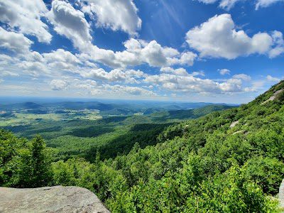
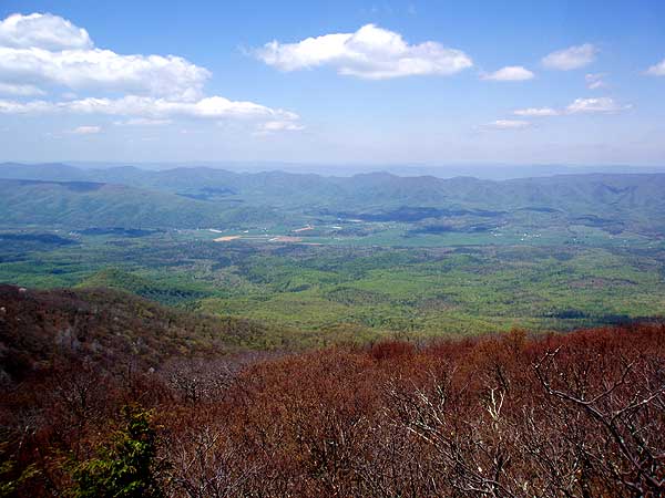
Elliott Knob is the highest point in Augusta County, and one of the highest peaks in Virginia. Just west of Staunton and secluded in Buffalo Gap, this hike features two waterfalls, several great views to the west and east, and a grass covered summit. If you’re lucky, this hidden treasure can be all yours for a day.
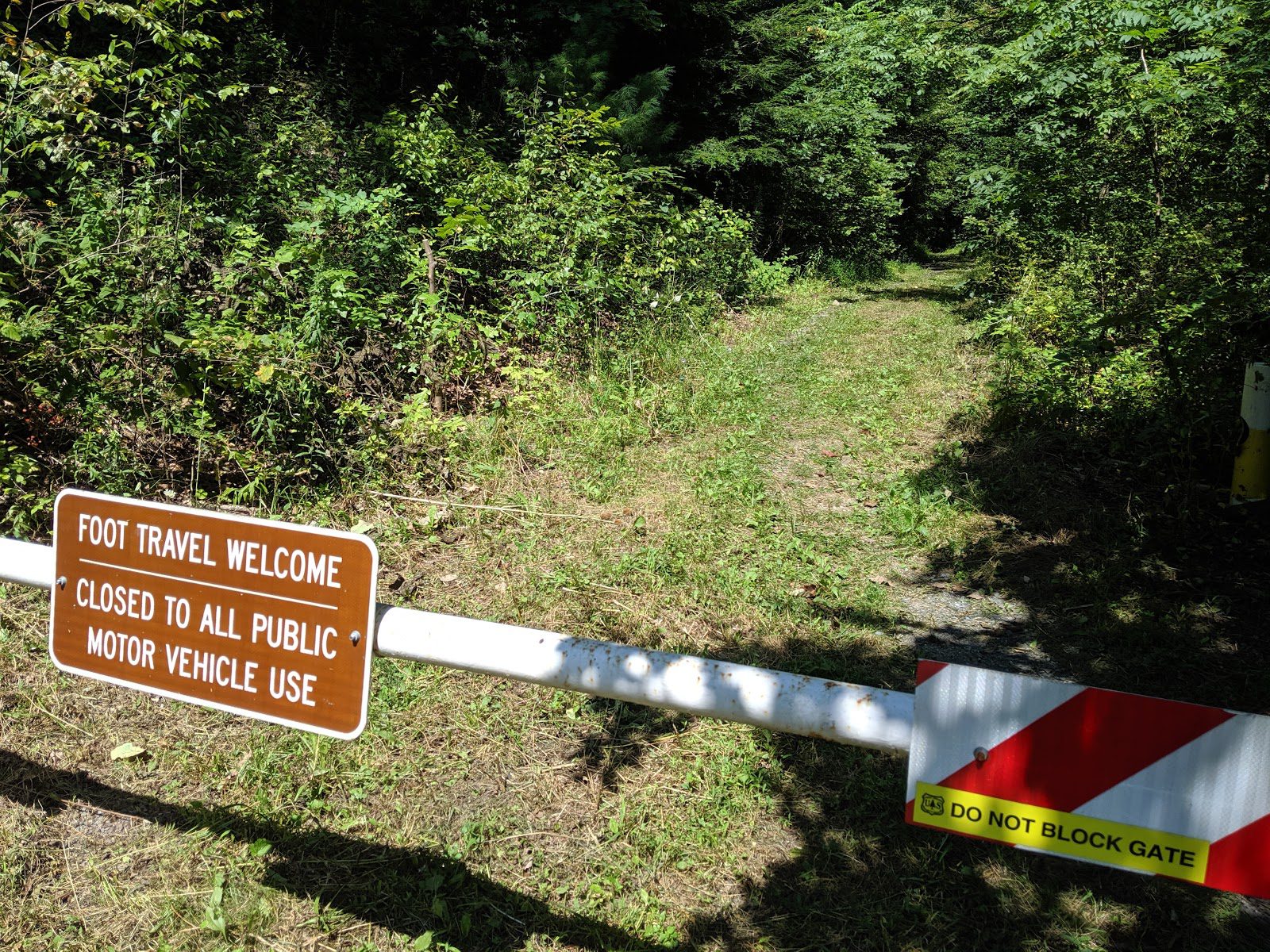
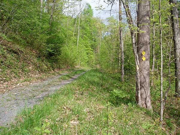
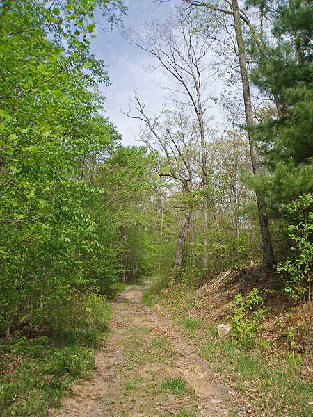
From the small parking area pass the closed gate and head up Falls Hollow Trail. The trail is marked with both yellow blazes and yellow plastic diamonds, and follows an old logging road for the first 1.5 miles.
At 0.4 miles pass a small logging road on your right, the first of four. In 0.6 miles from the parking area the trail makes a turn to the left before entering the first of three small clearings at 0.8 miles.
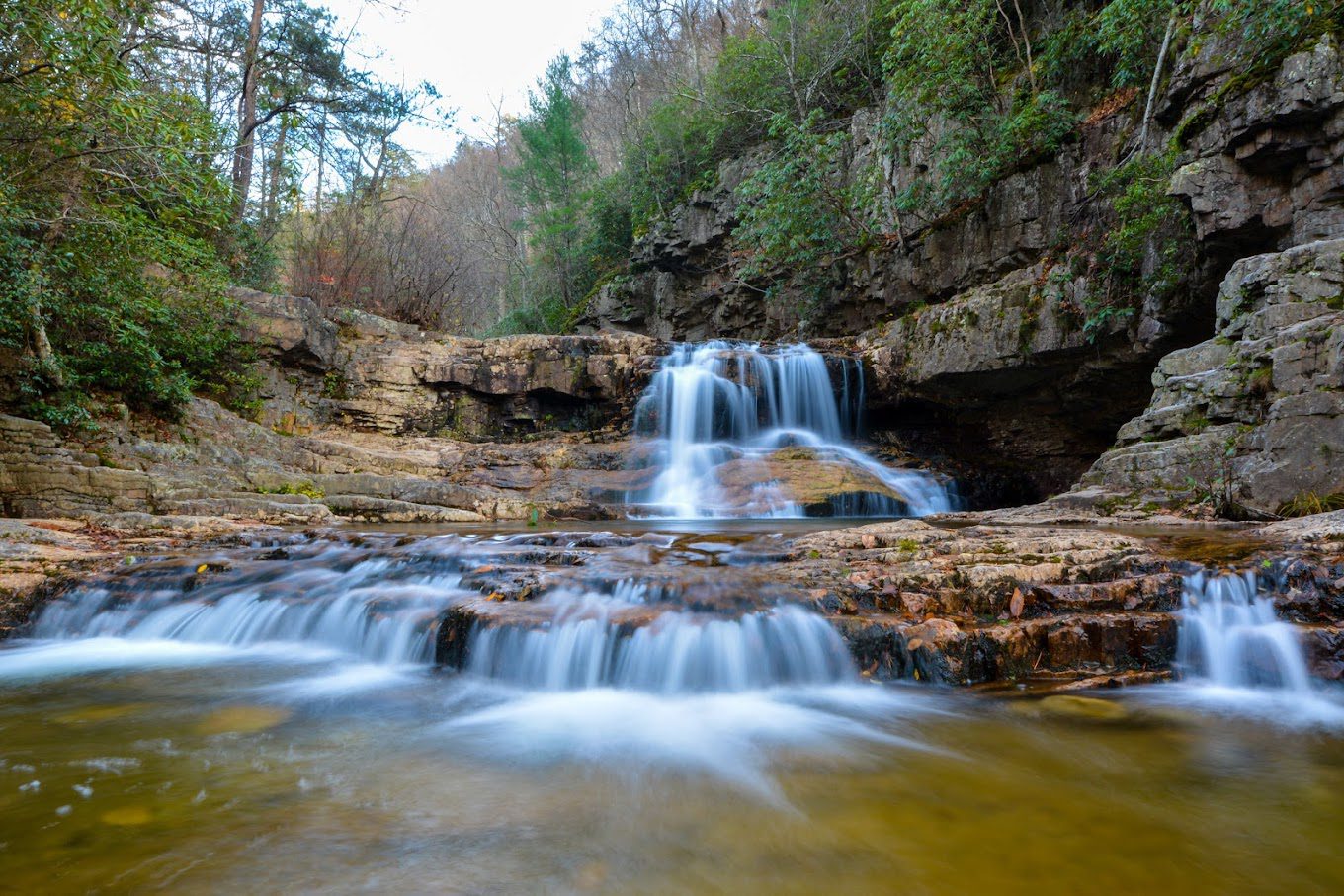
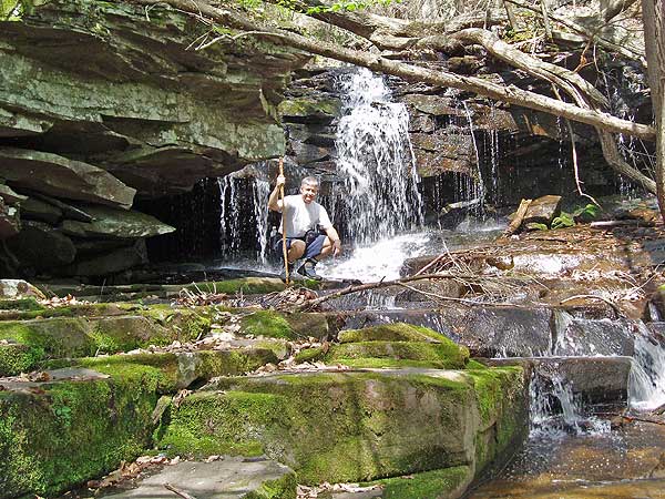
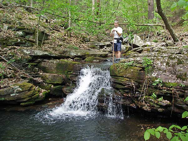
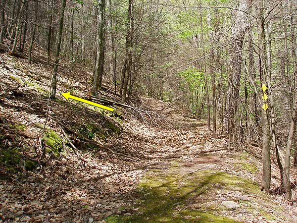
Pass through the clearings and arrive at Falls Hollow Run on your right in another 0.6 miles. Continue up the trail, cross the run, and in 50 yards reach the first of the two main falls. Cross the run again, where the trail becomes steep, then arrive at the largest set of falls in another 0.3 miles. There is a yellow diamond on a tree, and small pile of rocks marking the falls.
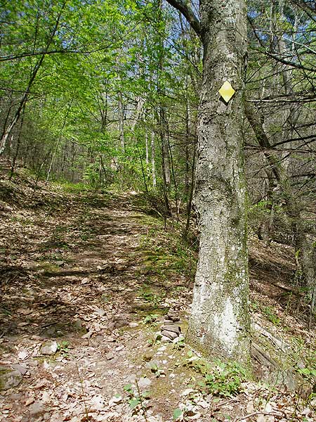
In another 0.1 miles the trail turns off the old FS road to the left. The turn is marked by three yellow diamonds. The old Falls Hollow Trail continues straight and is no longer navigable.
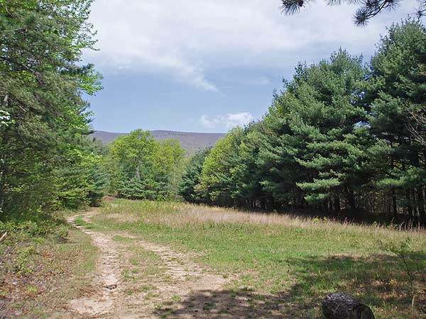
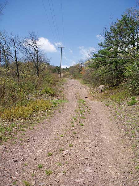
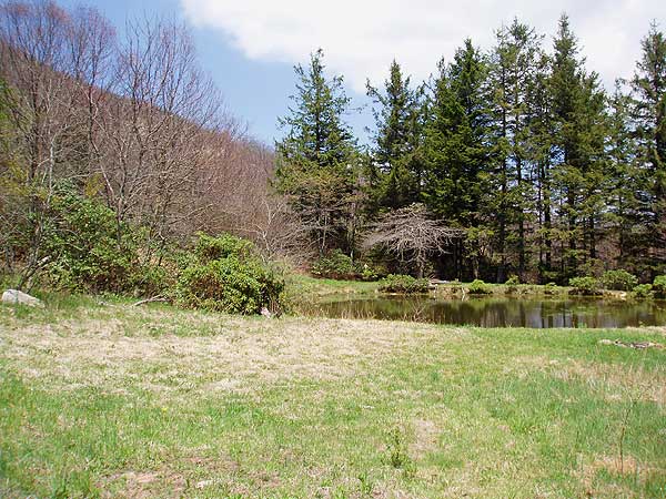
| After turning left on the yellow blazed trail continue 0.8 miles, crossing two small spurs, and passing through a utility clear cut before arriving at an access road. Turn right uphill on the yellow blazed dirt access road for the steepest part of the hike before arriving at a spring and small pond in 1.0 miles.
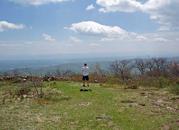
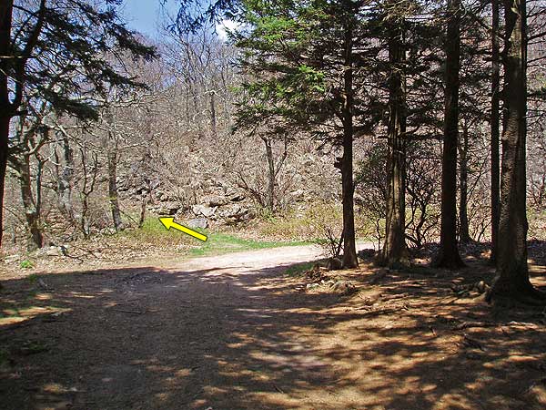
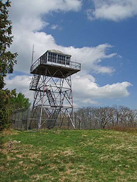
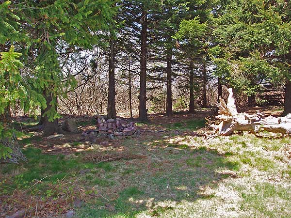
Continue along the road as it passes a small stand of spruce, winds back to the right, then to the left, passes the yellow blazed North Mountain Trail and transmission station, then enters another stand of spruce and flatter area. At this point the dirt road you have been following turns to the right towards the transmission station. Turn left onto the trailthat climbs on the west side of the mountain and up to the grass covered summit in another 0.1 miles. The lookout tower was built in 1958 and hasn’t been used since the early sixties. If you are doing this hike as a backpack there are two sheltered campsites under a stand of spruce at the summit. |
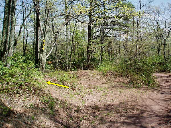
To return retrace the route you took up. However, be alert for the left turn off the steep dirt access road onto the trail that leads back towards the run. There are three yellow diamonds making the intersection, take the immediate left onto he trail.
Skyline Drive in Shenandoah National Park
Saint Mary’s Falls
Ravens Roost Overlook on Blue Ridge Pkwy
Luxury Amenities
Prime Locations
Spacious accommodations
Stunning views
Modern design
Impeccable cleanliness
Personalized experiences
Excellent customer service
escape to Extraordinary